1 / 1
Product Overview
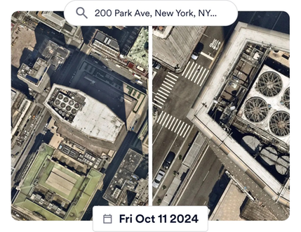
Nearmap is the location intelligence provider organizations rely on for consistent, high-resolution imagery and location intelligence. We proactively capture 1,700+ urban areas in N.A. up to three times a year. By combining Nearmap with Trimble Unity (Cityworks), you can:
• Enhance monitoring and maintenance of assets to mitigate risk
• Improve data consistency and quality between Unity and ArcGIS
• Save time and money by reducing physical inspections
• Ensure clear, consistent visual insights from the office to the field
Features
Simple GIS-centric Integrations
Nearmap integrates seamlessly with ArcGIS and asset management software, like Trimble Unity, allowing customers to incorporate aerial data into broader asset lifecycle management workflows. This integration enhances data utility, as it can directly support tasks like asset inspection, planning, and compliance within familiar systems.Nearmap Enhances Workflows for Faster Decision Making
Nearmap enhances its imagery data with AI-driven analytics, such as automated object detection, change detection, and property insights. This transforms imagery into actionable insights delivered as a service, enabling public agency users to make data-informed decisions, respond faster to emergencies, accurately plan capital improvement projects, and uncover hidden challenges with community development.High-Resolution Aerial Imagery on Demand
Nearmap provides frequently updated, high-resolution aerial imagery for AEC and government agencies that can be easily integrated into user applications like Trimble Unity or Business Center; allowing users to access and analyze up-to-date visuals of locations without the need for costly field surveys.
Support
View Full Support and ResourcesTrimble Unity Permit

Nearmap + Unity Permit
From imagery, to insights, to answers
Developer: Nearmap
- Works with Trimble Unity Permit
Attention
Please get in touch with your account owner for assistance. If you wish to make a purchase, we recommend signing out and creating a personal account.
