1 / 3
Product Overview
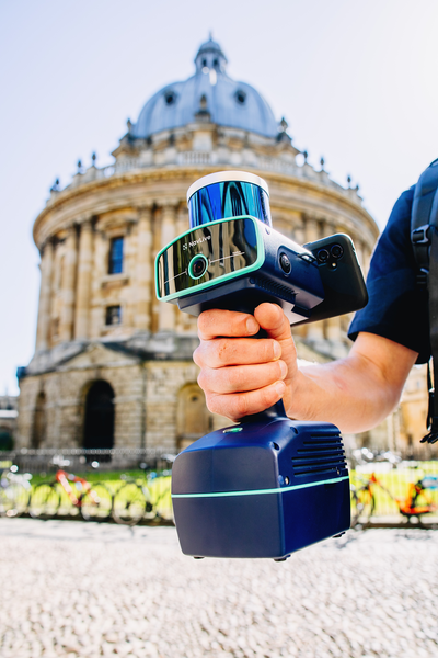
NavLive's construction scanner is relied on by architects and building professionals to generate real-time 2D and 3D models, collect detailed survey data, and speed up every stage from design to build. The scanner automatically displays accurate floor plans and sections as you scan, generating detailed, spatially-accurate point clouds ready for BIM and design tools.
Features
3D Building Reality Capture
Bring entire buildings to life in precise 3D. Capture walls, floors, and structural details in real-time, creating a complete digital representation you can use for design, renovation, or documentation. No complex equipment requirement, and no long processing times.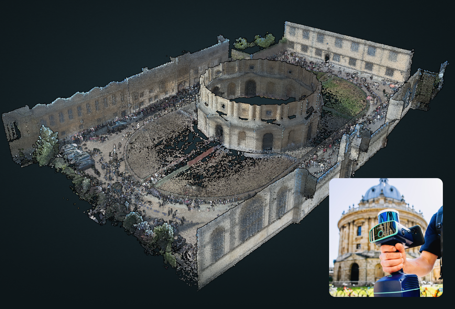
Fast 2D & 3D Floor Plans
Generates detailed floor plans in minutes simply by walking around the site with the NavLive Radius scanner in hand. This speeds up your workflow, helping you deliver projects faster and win more clients.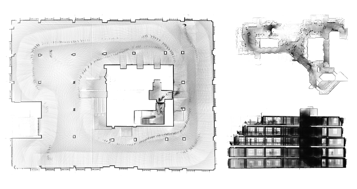
Direct Integration to Trimble Connect
Data captured on the NavLive scanner is available directly inside Trimble Connect. Anyone in your team can access scan data via their web-based browser, no matter where in the world they’re located. Alongside the 3D mesh, you can view the full point cloud, and even see the exact path taken during the scan. Click on any of the camera icons, and you’ll open an image captured by the scanner, a simple way to refer back to what was actually seen on site.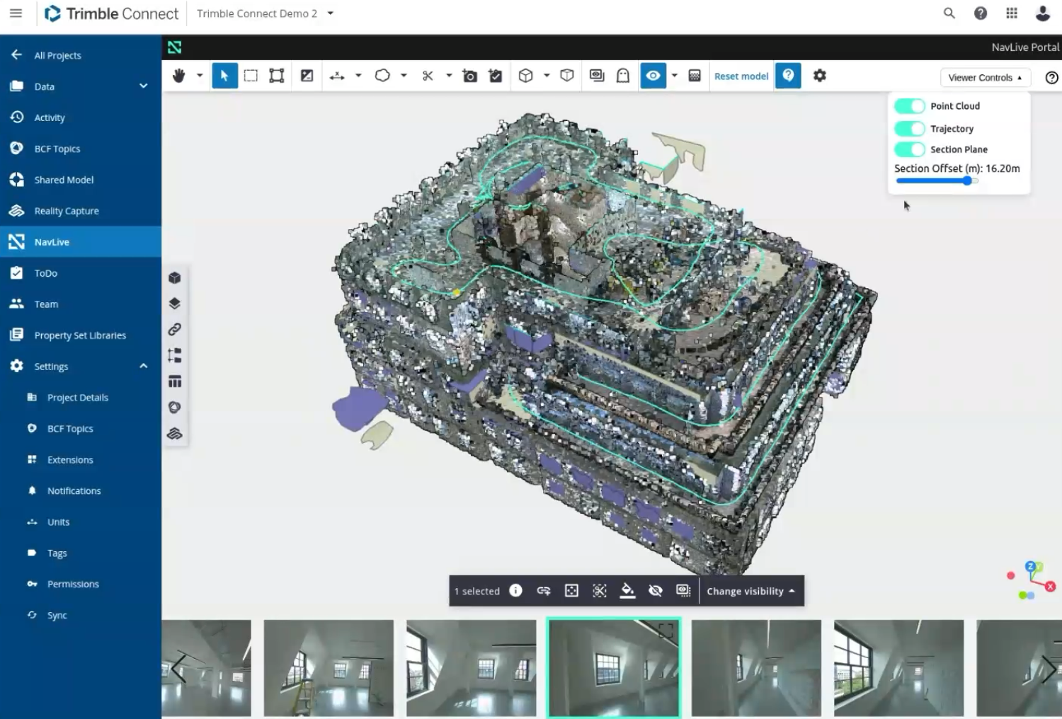
Instant Export to SketchUp
Export NavLive data into SketchUp with a click of a button. You'll see a full 3D mesh of your building data as a native .skp file, ready for modelling. A process that once took days can now be completed before lunch.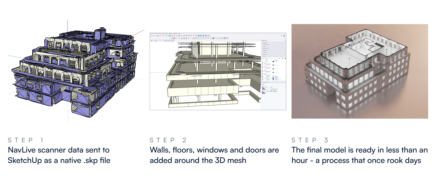
Categories
BIM
BIM
Reality Capture
Reality Capture
Support
View Full Support and ResourcesTerms & Conditions
BIM

NavLive + Trimble Connect
Handheld AI Construction Scanner
Developer: NavLive Limited
- Works with Trimble Connect
- Certified by Trimble
Attention
Please get in touch with your account owner for assistance. If you wish to make a purchase, we recommend signing out and creating a personal account.
